
How a Pocahontas County Property Search Moves from Address to Record
Start with a known house in WV Assessment Search. Enter the street name or the owner. If the list runs long, add county, district, map, parcel or sub-parcel. Open the parcel record and note its legal description, owner, mailing address, appraised values and deed book/page. Then carry that deed reference to the Clerk's index for the recorded instrument, the Sheriff WEB Tax Inquiry for bills and payments, and the map viewer for the location. The search is a chain of cross-checks. No one screen carries every detail.
- Enter an E-911 street address, owner name or parcel key in the assessment search and set Pocahontas County.
- Record the district, map number, parcel, sub-parcel and legal description from the matching result.
- Use the owner or deed book/page field to find the related County Clerk instrument.
- Compare the account and map-parcel in WEB Tax Inquiry, then inspect the same parcel on the map.
- Request a deed copy by book/page and document type if the online index does not show the needed image.
Property Search Fields in the Pocahontas County Assessment
The Assessor search runs in four modes: basic, appraisal/sales, advanced and prior ownership. The visible fields are a fallback. A street query can fail. So can an old tract description. Together those field choices offer a second route into the same Pocahontas County parcel, though no field promises a match for every account.
| Search group | Fields visible | When it helps |
|---|---|---|
| Basic | County, district, full parcel ID, owner, map, property class, street, parcel, tax class, sub-parcel, land use | Start with a known address, name or parcel key |
| Appraisal / sales | Land, building and total appraisal; acres; sale date, sale price and deeded acres | Compare record fields or narrow a sale search |
| Advanced | Flood hazard, mailing address, deed book/page, legal description, building year, structure counts and area | Research a rural tract or confirm a deed reference |
| Prior ownership | Separate prior-ownership mode and sale/appraisal fields | Find a past transfer lead before opening the deed index |
The WV Assessment Search page shows the statewide form used for Pocahontas County parcels. Start with one key alone. Add district or map details only if the result list stays broad.
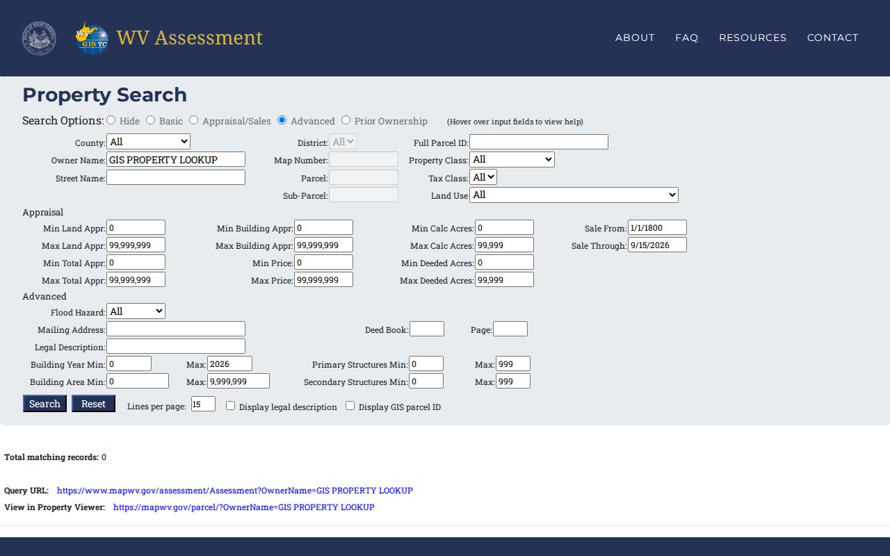
Save the exact field values that found the parcel.
Address Limits for a Pocahontas County Property Search
The statewide Property Viewer relies on E-911 street addresses. Rural routes and post-office boxes are excluded. So a failed search does not mean the parcel has no public record. Try the physical street name first. Then turn to the Assessor's Street Name, Mailing Address, owner, map or legal-description field. Keep both the situs and the mailing line. The first locates the property, while the second may route tax notices to an owner living elsewhere.
A postal place-name is not a municipal boundary. County records cover Marlinton, Durbin, Cass, Hillsboro and other listed communities, but a town line or a ZIP crossing can still blur. The district, map and legal description are stronger keys than any city name. Addresses get renamed and renumbered. When that happens, a former owner or an old mapcard opens another path into the Pocahontas County property records.
Finding Sales in Pocahontas County Property Records After July 1
The ordinary 2026 assessment view uses data collected July 1, 2025. Later sales live elsewhere. The county's tax-map notice points users to the parcel's “View Mapcard (Sales History)” PDF. That local step matters. A new deed shows the grantee sooner. The Assessor's Prior Ownership mode and sales filters add context, but only the recorded instrument confirms parties and the land description.
The WV Assessment Search page also displays the prior-ownership option and the sales and appraisal fields. Treat the mapcard date as a clue. Carry the deed book/page to the Clerk's index. Compare the recording date against the assessment date. A deed recorded after July 1 explains why owner names differ from one screen to the next.
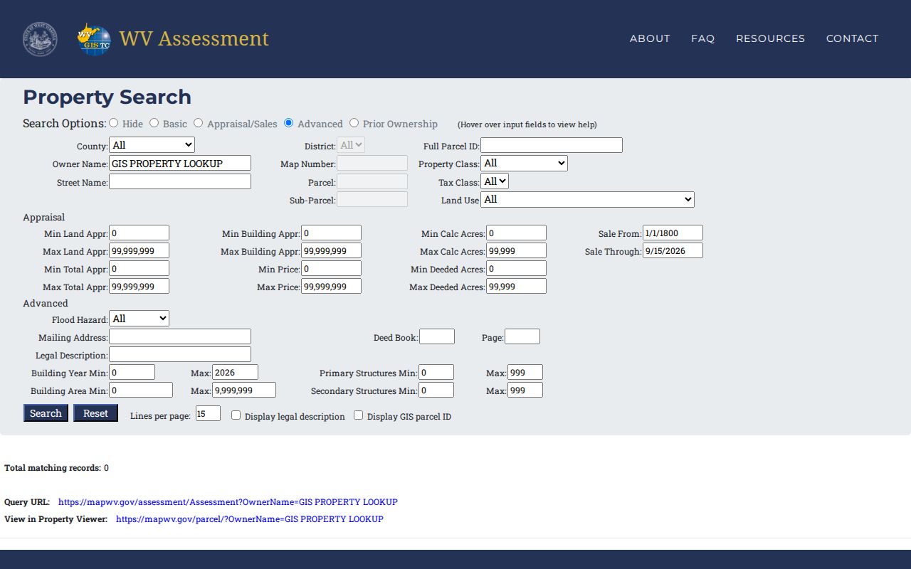
A mapcard may flag a later transfer. When it does, the newest recorded deed remains the confirming source for who owns the property now.
What a Pocahontas County Property Search Result Shows
Copy the field labels, not just the owner name. WV Assessment Search can expose far more than ownership. Physical and mailing addresses, parcel identifiers, property and tax classes, land use, legal descriptions, deed references, structure details, flood-hazard status, appraisal fields and sale history all sit inside the record. The tax-map viewer adds a mapcard and geometry. WEB Tax Inquiry adds the account and bill amounts. Remember that a search result is a current office view, not a certified chain of title.
| Owner name | Assessor owner field; open parcel detail because a map result may show only one owner |
|---|---|
| Physical / mailing address | Parcel situs and the separate address used for mail or billing |
| District, map, parcel, suffix | County parcel key to carry between the assessor, map and tax account |
| Appraisal and tax class | Land, building and total appraisal fields with use/class context |
| Legal description / deed book-page | Recorded land description and a pointer to the instrument |
| Sales history | Sale date and price fields, with later transfers in the mapcard PDF |
These fields have limits. They do not prove every co-owner is shown, that liens are cleared, or that a tax-map line is a surveyed boundary. The assessment search points to a deed. The deed itself must still be read. Parties and legal descriptions live in the instrument, so treat each result as an index into the county's records rather than a title guarantee.
Using a Deed Book and Page in the Search
A deed book and page number is the handiest link between two records. The WV Assessment Search exposes both as advanced fields. An Assessor card often names the instrument behind an ownership entry. Keep that reference close. It moves a parcel from an assessment screen to the recorded land record itself.
The County Clerk builds requests around it too. Book and page plus document type are what the office asks for. A preferred delivery method completes the request. Supply the same reference whether you search online or mail a request. Then check the instrument's legal description against the parcel you started with.
The online land-record landing page covers deeds, deeds of trust, liens, releases, plats, assignments, and agreements. Affidavits appear there too. The county does not state its date coverage. Nor does it list the search syntax the image endpoint accepts. An empty result is rarely final. Try a party-name spelling variant or the legal description. A book and page request through the Clerk works as well. Do not conclude a deed was never recorded until then.
Map Search and Parcel Exports in Pocahontas County
Two map tools put Pocahontas County parcels on screen. The Pocahontas Tax Maps ArcGIS viewer and the statewide WV Property Viewer tie an address or owner to mapped parcel geometry. The state viewer offers address, owner, parcel, geometry, and coordinate modes. Detail fields and links come with each result. Its export controls produce CSV and KMZ files. That makes it easy to keep a parcel list or study neighboring shapes.
One caution matters here. The county disclaimer says tax-map lines are not a survey plat. A drawn edge on the screen settles nothing legal about a boundary.
Capture the assessment parcel key first. Then use the map to explore, not to identify the tract. The first map label can be incomplete. So open the detail panel for the physical address, owner, and parcel attributes. A parcel can sit inside a recorded subdivision. The Clerk's plat index and the legal description supply the record context behind the geometry. In short, the map is location evidence; the deed is the instrument evidence.
When a Pocahontas County Property Search Comes Up Empty
A blank result does not mean the parcel is missing. Try the same parcel through a second field. Drop a directional from the street name. Search the owner spelling without punctuation. Or borrow the map and parcel identifiers from a neighboring assessment record. Rural land often hides behind its legal description or deed reference rather than a mailing address. A variant spelling can surface the record, but compare the returned land description before calling it a match.
Both offices take direct questions. The County Clerk sits at 900 C 10th Avenue in Marlinton, reachable at 304-799-4549, Monday through Friday, 8:30 a.m. to 4:30 p.m. The Assessor is at 900 10th Avenue, Suite I, at 304-799-4750. The county publishes no start year for its online deed index and no image charge. Ask the Clerk about older volumes or a book and page copy request, and ask the Assessor to check map, parcel, and legal-description fields.
Choosing an Address, Owner, or Parcel Search
Pick the key least likely to be ambiguous. A street search works well when the county's E-911 address is known. An owner search suits a portfolio or a name lifted from an old deed. A full parcel key is strongest when two nearby tracts share a road name. WV Assessment gives each its own field. The fields include street, mailing address, owner, full parcel ID, map, parcel, sub-parcel, and legal description. The labels are not interchangeable. Write down which one produced your result.
| Search Key | Best For | Where It Works | Watch Out |
|---|---|---|---|
| Street / E-911 address | Locate a known building or parcel | WV Assessment and statewide viewer | Rural routes and PO boxes do not work in the viewer |
| Owner name | Find parcels indexed to a person or entity | WV Assessment; deed index for instruments | Names can be shared or held by an LLC or trust |
| Map / parcel key | Match one parcel across county systems | Assessment, tax map and WEB Tax Inquiry | Keep district, suffix and sub-parcel details |
Rural tracts carry two addresses, and the difference matters. One is the physical E-911 location the statewide viewer understands. The other is the mailing address tied to an owner or tax account. The viewer rejects a rural route or PO box as an address key. When a mailing address is all you have, use the Assessor's street-name, mailing-address, owner, legal-description, or parcel fields. Even a mailing match still needs a map-parcel and description check. It does not count as the same land until then.
When a likely result appears, save everything exactly as displayed: district, map, parcel, any sub-parcel suffix, and the deed book and page if shown. Each system in Pocahontas County indexes land differently. WEB Tax Inquiry runs on an account number and map-parcel. The Clerk's index runs on parties and instrument references. Carrying one parcel description across both separates a tax ticket from a deed. It also makes any follow-up request reproducible.
Treat an owner-name result as a starting list, not a unique-person match. The Assessor's prior-ownership and appraisal/sales modes return sale dates and deed clues. They do so for multiple parcels at once. A common surname needs narrowing. Add a district, street, acreage, parcel key, or legal description. Then compare the candidate's deed reference against the Clerk's index. If two cards still look alike, keep both open until the land description resolves which one fits.
Not a title search. A Pocahontas County property search helps find records held by public offices; it does not determine whether title is clear or whether a boundary is exact. For a transaction, use a qualified title professional and surveyor.