
How to Search Durbin Property Records
Begin with a full E-911 address in the WV Assessment Search. If the address is unclear, fall back on the owner of record, the district, map, and parcel key, or the legal description. Open the property card and note the parcel number and legal description. Then check the latest deed in the County Clerk index, compare the tax account in WEB Tax Inquiry, and set the parcel on the county map. Permits and zoning are different. The town keeps those files, and Durbin publishes no online permit lookup, so call the municipal office for an address-based record. Railroad-era place names can point toward an instrument. Test them against the legal description rather than trusting them alone.
- Search the E-911 street address in WV Assessment; rural routes and PO boxes are not viewer search keys.
- Capture the district, map, parcel, legal description and any sale-history reference.
- Check the County Clerk deed index and WEB Tax Inquiry with the parcel details.
- Inspect the parcel in the county tax map or statewide viewer.
- Ask Durbin's town office for address-based permit, zoning, floodplain or code records.
The Pocahontas County property search guide walks through the shared portal fields. Durbin's twist is the old place-name problem, where a deed may not match the mailing address you have in hand.
Where Durbin Property Records Are Kept
Pocahontas County holds the official records. The County Clerk records deeds and other land instruments. The Assessor keeps the appraisal and assessment cards. The Sheriff issues the tax bill, and county mapping tools show parcel geometry. Durbin has no separate assessor or deed recorder. The town office handles permits and zoning. Durbin offers no official web lookup, published fields, or fee schedule for those records. For anything address-based, ask the municipality directly and keep the county parcel number handy.
Pocahontas County Records
The county Clerk, Assessor, Sheriff and map tools hold Durbin's deed, roll, tax and parcel trail.
Durbin Permits and Zoning
No official online permit or zoning lookup was located.
Ask the town office for address-based building, zoning and code records.
Town contact details were not verified in the research.
Railroad and Tract Clues in Durbin Property Records
Durbin sits in railroad country, and that history shapes its records. An old deed or plat may name a community, a rail line, or a tract that matches nothing on a current mailing address. Use that wording to find a candidate instrument. Then compare its legal description, deeded acreage, and book and page against the Assessor parcel. A familiar railroad label alone never proves two records describe the same land. The Pocahontas County Historical Society preserves logging and railroad materials, and the county library's about page lists the Cass Scenic Railroad among local attractions. Both can help decode a place reference in a deed. The transfer itself still must be confirmed in the County Clerk's deed records. The Historical Society's museum and archive page describes its local collections.
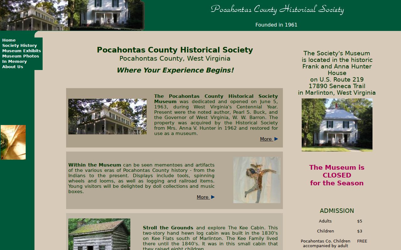
Treat a historic artifact or story as context only, never as a stand-in for a deed or plat.
Library Resources for Durbin Property Records Research
The county library system runs a Durbin Community Library branch. It offers public computers, copying, scanning, faxing, and research databases. Its McClintic Heritage Room keeps local history in-house. The Pocahontas Times is digitized and searchable for patrons. In-library Ancestry access is available, and WV Info Depot may be reachable from home with library password information. These tools can surface an old family name or place-name clue tied to Durbin. When a newspaper or book points to an owner or tract, take that name to the County Clerk index. The library supplies historical context. It does not hold the county's deed chain. Durbin property records stay with the assessor and clerk systems. That holds true no matter where the history research happens.
Durbin Neighborhood and Plat Names in the Records
No official source publishes formal Durbin subdivision names, plat books, parcel-prefix ranges, or development eras. The table below separates genuine community and history clues from an actual recorded subdivision. Older deeds lean on railroad, community, or tract language. A current mailing address often goes unmentioned. The deed's legal description is the dependable bridge back to the parcel.
| Neighborhood / Subdivision | Era | In the Records |
|---|---|---|
| Formal Durbin subdivisions | Names and eras not verified | Ask the Clerk for indexed plats; do not infer a name from a map label |
| Railroad or tract references | Historical setting; exact land runs not verified | Use as deed-search terms, then compare legal description and acreage |
| Durbin Community Library area | Branch location; not a subdivision name | Local research access, not a parcel or title source |
Run any railroad or tract wording through the deed index as a lead. Then compare the recorded description with the tax map. The Pocahontas County parcel maps guide shows how to pull up the geometry without mistaking it for a survey.
Address and ZIP Clues for Durbin Property Records
Durbin's ZIP geography is not a settled matter here. The same goes for its post-office station, boundary crossings, and any historical ZIP changes. Start instead with a complete E-911 street address in the statewide viewer. It rejects rural routes and PO boxes. If that fails, try WV Assessment's street, owner, map, parcel, or legal-description fields. Keep the physical address the parcel returns. A postal city name proves nothing about municipal limits. The county tax map and the recorded legal description identify the property. For a jurisdiction boundary, ask the town or the county mapping authority. Keep mailing and physical addresses separate whenever you search Durbin property records.
Durbin Incorporation and Annexation Records Need Local Confirmation
Official sources list Durbin as a town. They publish no incorporation date, annexation history, boundary growth, enclaves, or unincorporated pockets. No zoning map or annexation ordinance appears in the public record. A modern map label cannot supply a town-era timeline, so do not build one. For a jurisdiction question, request the ordinance or boundary record from the town clerk. The county commission may hold it as well. Then rely on the County Clerk plat and parcel description for the tract itself. None of this changes who custodies the land files. Pocahontas County assessment and deed records still carry the ownership trail for every Durbin parcel.
Durbin Permit Records Have No Verified Web Portal
Durbin publishes no searchable permit or zoning portal. Fees, coverage years, case status, and downloadable files are likewise absent. They are missing from the town's web presence. Anyone needing building, zoning, floodplain, or code records for a Durbin address should ask the town directly. The Assessor does expose a flood-hazard field. Its guidance says a floodplain determination should be filed before structures go up. Treat that as county assessment advice, not evidence of a town permit system.
When you review land, tie any town response to the same physical address and county parcel key. A permit file and an ownership deed answer different questions. Keep them as separate records.
Assessment Timing for Durbin Property Records
Durbin sits inside the county and state tax framework. Ownership, use, and value are measured each July 1 for the following calendar tax year. The general assessment relationship is 60 percent of fair market value. The Board of Equalization and Review begins February 1. State tax material describes annual assessment with a three-year cycle of physical visits. Rural tracts may carry farm-use or managed-timberland records. The county publishes no Durbin-specific value trend or revaluation effect, so treat those figures with care.
The county map notice dates its 2026 data to July 1, 2025. It points readers to the mapcard sales-history PDF for later transfers. Compare that sale clue against the recorded deed. Do not treat the owner-of-record or value fields as current on the same day.
A Durbin-to-Courthouse Search Route
Start with a known Durbin building. Save the E-911 address. Open the WV Assessment parcel and note its map/parcel key and legal description. Use the mapcard to spot any sale after the July 1 snapshot. Then search the Clerk index for the current grantee or prior grantor. WEB Tax Inquiry can match the map-parcel to a tax ticket. For an older tract, include the railroad, community, or acreage wording in a clerk question. Confirm every match against the described land.
When the online route ends, ask the Clerk about deed books and courthouse materials. The exact online cutoff and county image fee are not published. Verify access directly. Do not assume the local chain of records stops at the first web result.
What Durbin Property Records Show and Their Limits
Durbin property records can show a recorded deed. They can also show an assessment value, a tax account, and a map parcel. The town label does not create a separate county record system. Remember the limits. The map is not a survey. A tax value is not a sale appraisal. A deed index is not a complete title opinion. Durbin permit and zoning files are not online. Request them from the office that holds them.
Lawful use. Use Durbin property records for land-history, ownership and civic research. Do not use owner details to stalk, harass, threaten or harm anyone, and confirm consequential facts with the custodian.
Railroad, community, and tract wording can sharpen a search in Durbin. An older instrument may identify land by a place reference. It may not use a current street number at all. Keep the exact phrase from the deed. Test it alongside the grantor or grantee name. A search may return several tracts. Compare acreage and adjoining-land language with the assessment parcel before assuming two records describe the same property.
The county record route stays the same even when a local label is unfamiliar. Open the parcel card. Note its map and parcel identifiers. Then use the Clerk's index for the recorded transfer. The library and Historical Society can help interpret local history or a railroad reference. Neither is the custodian of current ownership, assessment, or tax records.