
How to Search Marlinton Property Records
Start a Marlinton lookup in the county assessment search. Enter the E-911 street address, owner of record or parcel key. Open the card. Note the owner field, situs, mailing address, district/map/parcel identifier, legal description and deed reference. Take the grantee or book/page to the County Clerk index next. Compare tax details in WEB Tax Inquiry, and orient the parcel with the Tax Maps viewer. Those shared systems are the county's own tools. The one Marlinton-specific step is a call to the town about a permit or zoning file. The town publishes no online permit lookup.
- Search the address in WV Assessment and note the parcel key and legal description.
- Use the County Clerk deed index to confirm the latest grantee and instrument.
- Compare the map-parcel and tax year in WEB Tax Inquiry.
- Open the parcel in Pocahontas Tax Maps or the statewide Property Viewer.
- Ask the Marlinton town office for address-based permit, zoning or code records.
The county's Pocahontas County property search walkthrough covers each portal field in detail. Marlinton address and history clues follow here.
Where Marlinton Property Records Are Kept
County offices hold the records themselves. The County Clerk records deeds and other land instruments. The Assessor keeps the parcel and value roll. The Sheriff handles tax accounts, and county mapping tools show tax-parcel geometry. Marlinton parcels sit in those same systems alongside rural ones. Town permit, zoning and code files are a separate municipal matter. The town publishes no online permit interface. An address-based request goes to the town office directly.
Pocahontas County Records
The Clerk, Assessor, Sheriff and mapping tools hold the deed, assessment, tax and parcel trail for Marlinton.
Marlinton Permits and Zoning
No official online permit or zoning lookup was located.
Ask the town office for address-based building, zoning and code records.
Town contact details were not verified in the research.
The Marlinton Courthouse as a Property-Records Hub
The courthouse at 900 Tenth Avenue anchors Marlinton's role as county seat. The building houses the County Clerk and Circuit Clerk. It also holds the magistrate clerk, Sheriff and tax office, Assessor and county commission. Its records room archives county deeds along with marriages and births. That layout makes an in-person cross-check easy when an online index or mapcard is unclear. The courthouse is not a city recorder. It also creates no separate municipal tax roll.
The official state profile names Marlinton as the Pocahontas County seat. It says nothing about a current population rank among county towns. Treat that as unconfirmed. Use the courthouse as a custodian location and the legal description to identify land. Marlinton property records stay part of the county system. That holds even when the situs label names the town.
Marlinton Neighborhood Names and Subdivision Records
No official source confirms formal Marlinton subdivision names, plat-book runs, built eras or parcel-prefix conventions. That gap stays open here rather than dressed up with local landmarks renamed as subdivisions. The courthouse can orient a search. So can the historic places listed below. Only a recorded plat or deed establishes a lot name and its legal description.
| Neighborhood / Subdivision | Era | In the Records |
|---|---|---|
| Formal Marlinton plats | Names and eras not verified | Ask the County Clerk for indexed plats and compare the deed description |
| Courthouse / 900 Tenth Avenue | Government cluster, not a subdivision | Use as a records-office anchor only |
| McClintic Library / 500 8th Street | Current library location; not a plat name | Heritage Room clue for local history, not ownership proof |
When a Marlinton deed names a subdivision or lot, quote that exact wording in any County Clerk request and check it against the parcel's legal description. The Pocahontas County parcel maps guide explains how the map helps locate a parcel without serving as a survey.
Marlinton Address, Mailing and Town-Boundary Clues
Keep three things separate: the municipal boundary, the mailing place and the E-911 situs. The statewide viewer searches E-911 street addresses only. Rural routes and PO boxes are excluded. The Assessor offers both Street Name and Mailing Address fields. This helps when a postal label fails to locate a parcel. Marlinton's annexation history, street renumbering, enclaves and out-of-town Marlinton mailing labels go unreported in official sources. So verify locally.
When a boundary question matters, compare county geometry with the legal description. Then confirm municipal status with the town or county mapping authority. A postal city is a clue, not proof of jurisdiction. Key Marlinton property records by parcel whenever the street label is uncertain.
ZIP Code 24954 and Marlinton Property Records
Official pages confirm Marlinton, WV 24954. They say nothing about whether the ZIP crosses the municipal boundary. They also say nothing about PO-box-only routes or a ZIP-wide search in the property portals. Check delivery geography in USPS ZIP Code Lookup first. Then use E-911 and parcel data to locate the land. A mailing ZIP can cross a town line or differ from the property's legal setting. Never infer municipal status from it.
The Assessor's Mailing Address field and the viewer's physical address answer different questions. Preserve both, plus the parcel key and legal description, in any record request. That keeps a city ZIP from being mistaken for the situs or a boundary.
Marlinton Permit and Zoning Records Have No Verified Online Search
The town of Marlinton publishes no online permit or zoning search. Fees, coverage years, and case history are not posted on the web. Ask the town clerk or municipal office. Property owners with a work-history question can request files tied to a street address. Keep that request separate from county ownership records. An Assessor card and a deed can identify the parcel. Neither one lists every permit or code file a town may hold.
The County Assessor also notes a county rule. A floodplain determination must be filed before structures go up. That county rule is helpful context. It is not a town permit or a zoning approval. Confirm each record with the office that keeps it.
Historic Places That Help Read Marlinton Property Records
Historic sites in Marlinton can help decode an old address or family name. The McClintic Heritage Room sits at 500 8th Street and keeps local-history materials on site. The Historical Society's Frank and Anna Hunter House museum stands at 17890 Seneca Trail along U.S. Route 219. The Society says it bought the property in 1962. It restored the house. The museum opened in 1963. The Kee Flats setting sits nearby. It includes a hand-hewn two-story cabin built in the 1830s on the Society grounds. Newspaper mentions and place names can point a search in the right direction. Any ownership claim still needs the deed and recorded plat to stand. The library collections page describes the Heritage Room and its local-history resources.

Place-name clues guide the hunt, but a deed and recorded plat settle any ownership question. The Historical Society describes its museum and archive work.
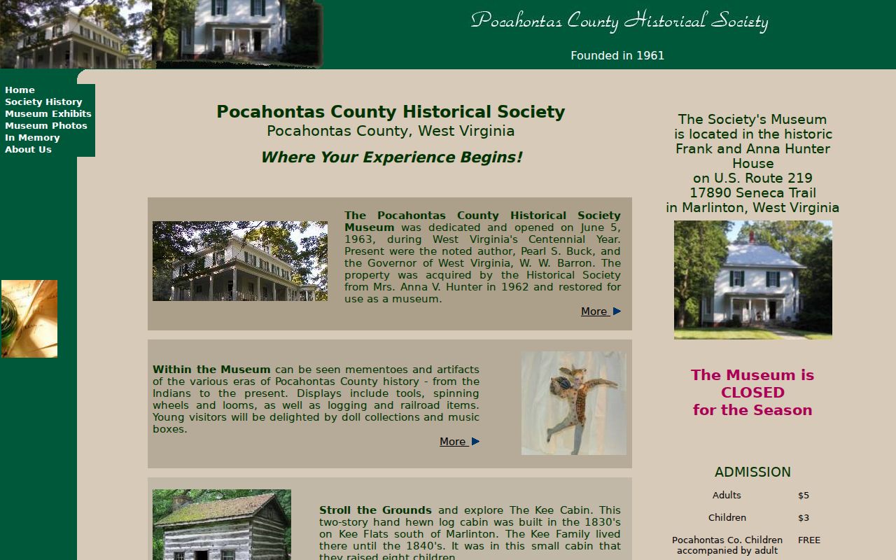
These landmarks are history clues, not subdivision names or title evidence.
Assessment Class and Value Timing for Marlinton Parcels
Marlinton parcels inside the town boundary fall under West Virginia Class IV unless another class applies. Class II is a separate category for qualifying owner-occupied residential property. The state generally assesses at 60 percent of fair market value. It uses July 1 ownership, use, and value figures for the next calendar tax year. Board of Equalization and Review activity begins February 1. These countywide rules shape the tax record. They do not set an individual sale price.
The county GIS notes that its 2026 assessment data reflects July 1, 2025. Later transfers appear in the mapcard sales-history PDF. No Marlinton-specific appreciating district or historic-district overlay exists on record. Rely on the parcel card and deed dates. Avoid assuming any townwide trend.
What Marlinton Property Records Show and Their Limits
Marlinton property records can show a deed, an assessment value, a tax account, and a mapped tax parcel. Each piece lives with a different custodian. The records do not establish every ownership interest. They set no surveyed boundary and offer no individual market appraisal. The town's permit and zoning file is separate too. Confirm the deed with the Clerk. Ask the Assessor about parcel fields. Request municipal material from the town when needed.
Lawful use. Use Marlinton property records for ownership, land-history and civic research. Do not use owner information to stalk, harass, threaten or harm anyone; a search is not a title opinion or survey.
Marlinton's county-seat role puts several record offices near one another. Their records answer different questions, though. The County Clerk at 900 C 10th Avenue handles recorded instruments. The Assessor at 900 10th Avenue, Suite I, maintains assessment and parcel information. Use the Clerk for a deed or plat reference. Use the Assessor for a parcel card, class, or value field. The town offers no verified permit or zoning lookup online. So request those local files from the town rather than inferring them from a county tax card.
For an older Marlinton address, preserve the street wording. Also preserve any parcel description in the deed. A ZIP label such as 24954 helps with mail and orientation. It cannot locate a lot or confirm a municipal boundary. Compare the current E-911 or map-parcel result with the recorded instrument. That check matters most after a street name or owner changed. Compare it against the historic record.